The Roman army passed through what is now Dunsyre parish in the first century AD, and the evidence of that passage can still be traced in the landscape today.
Agricola's route
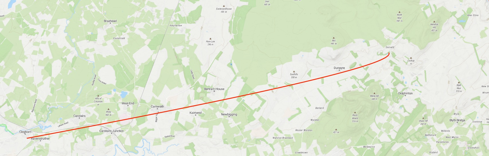
The line by which the army of Gnaeus Julius Agricola, Roman governor of Britain from AD 77, reached the camp at Cleghorn runs through the parish of Dunsyre. The route can be traced north through the county of Tweeddale and into Lanarkshire, marked in places by an earthen dyke that still survives in the landscape.
The Rev. William Meek, writing the Statistical Account for the parish in 1834, describes the natural geography that made this route inevitable: "The entrance to the glen or valley where Dunsyre is situate is called the Garvald or Garrel; it forms the most natural and easy communication betwixt the east and west of the plain." The Garvald pass, cutting through the hills at the eastern end of the parish, was simply the easiest way through the terrain, as useful to a Roman general as to a carrier heading to Edinburgh market eighteen centuries later.
Cairns and burial urns
Several burial cairns have been found in the parish and the surrounding area. In some of these, urns have been recovered, one described in the Statistical Account as about six inches in diameter, composed of burnt clay, and "rudely carved over." Its lower part was narrow, shaped like a human heart, and it projected from a depth of seven inches towards the mouth. These are sepulchral urns of a type associated with Bronze Age and Iron Age burial practice, suggesting the valley was inhabited and the hills used as burial grounds long before Rome arrived.
The Roman road itself is marked out by a dike of earth running through the Garvald. "Several cairns occur here and in the neighbourhood," Meek notes, their presence suggesting this was already a significant routeway in the landscape long before the legions made formal use of it.
The entrance to the glen is called the Garvald or Garrel; it forms the most natural and easy communication betwixt the east and west of the plain. Through this rugged pass lies the Roman line, marked out by a dike of earth.
Sources
New Statistical Account of Scotland (1845), Vol. VI, Lanark, Parish of Dunsyre. Available via the EDINA Statistical Accounts service.